
Discover Canada’s Forgotten Places with One Complete
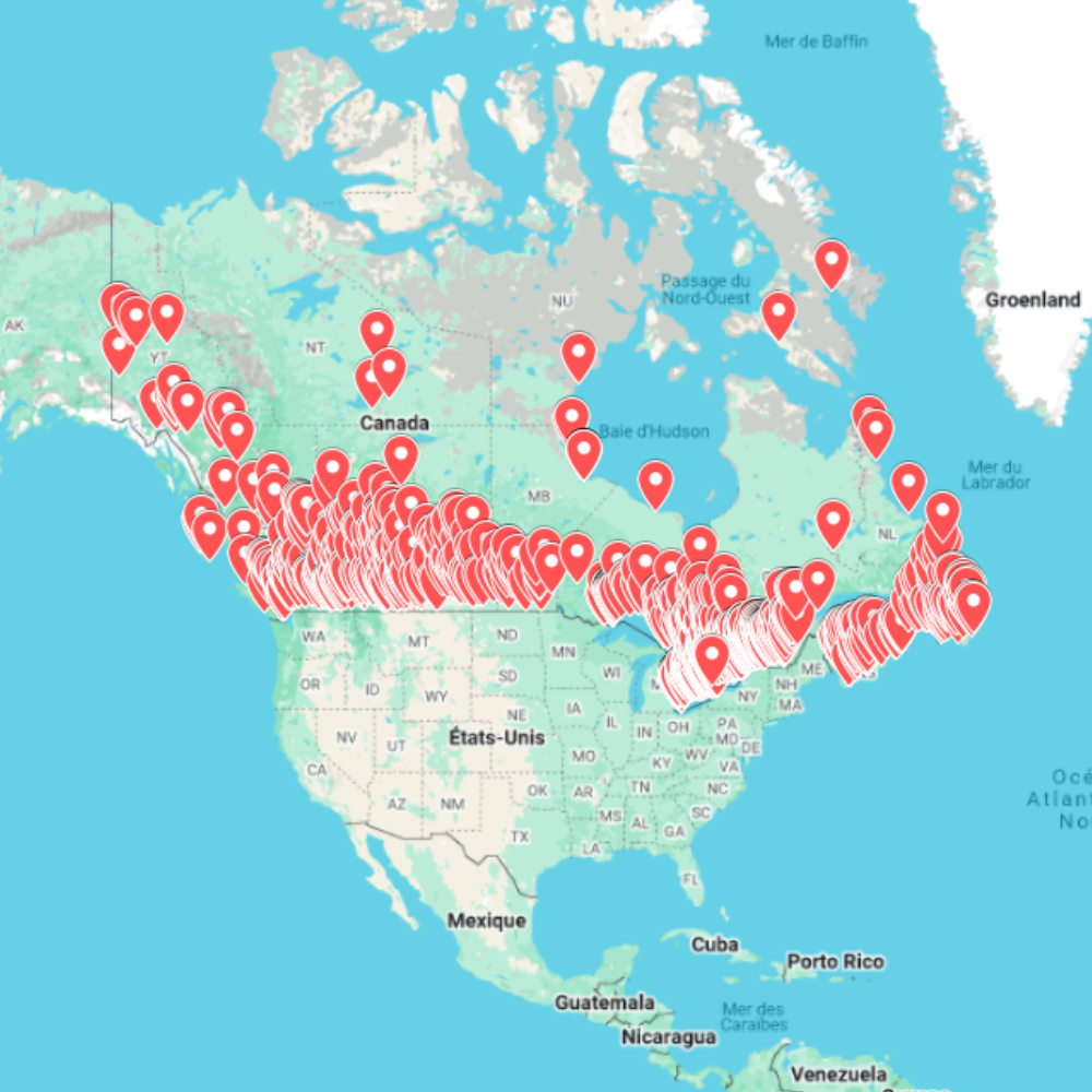
Canada is home to thousands of abandoned locations hidden within forests, mountains, mining regions, and former industrial centers. The Urbex Map Canada brings together 2,353 carefully organized exploration spots inside a single GPS database, allowing explorers to prepare their adventures without spending hours searching multiple websites.
From abandoned mining communities to forgotten hospitals, empty factories, and isolated rural buildings, this digital map offers an efficient way to discover Canada’s rich industrial and architectural heritage. Every location is organized in a format compatible with popular mapping software, making trip planning simple whether you’re exploring locally or traveling across the country.
Rather than relying on incomplete online information, this urban exploration map provides a structured resource that helps optimize route planning while offering access to a diverse range of abandoned environments. It is designed for explorers looking to document history through photography, videography, or architectural observation.
Whether you’re searching for atmospheric industrial ruins, remote ghost towns, or historic public buildings, this Canada Urbex Map offers an organized starting point for your next exploration project.
Cities & Regions Included
- 🍁 Ontario : Ontario contains one of Canada’s largest collections of abandoned industrial sites, former hospitals, schools, and manufacturing complexes. Many locations reflect the province’s long industrial history and urban development.
- 🏔 British Columbia : British Columbia offers a unique mix of abandoned mining settlements, forestry infrastructure, mountain lodges, and isolated buildings surrounded by spectacular natural landscapes.
- ⚜ Quebec : Quebec features abandoned factories, churches, hospitals, convents, and historic institutional buildings. The province combines architectural heritage with numerous forgotten urban locations.
- 🌾 Prairie Provinces : Across Alberta, Saskatchewan, and Manitoba, explorers can discover abandoned grain elevators, rural schools, farms, railway infrastructure, and former industrial facilities spread across vast open landscapes.
- 🌊 Atlantic Canada : The eastern provinces include abandoned fishing villages, coastal structures, military installations, and maritime buildings that showcase Canada’s Atlantic heritage.
Types of Spots Included
The map includes numerous categories of abandoned places, including factories, hospitals, hotels, warehouses, churches, schools, power stations, military sites, office buildings, transportation infrastructure, ghost towns, farmhouses, mines, and historic public buildings. The diversity of locations makes this database suitable for urban exploration, landscape photography, documentary filmmaking, architectural research, and location scouting.
Why Choose This Urbex Map?
✔️ Extensive database covering all of Canada
✔️ Carefully organized GPS coordinates
✔️ Instant digital download after purchase
✔️ Saves countless hours of online research
✔️ Compatible with Google Earth and Google My Maps
✔️ Built for photographers, explorers, filmmakers, and content creators
Technical Specifications
- File Format: .KML / .KMZ
- Delivery: Instant Digital Download
- Compatibility: Google Earth et Google My Maps
- Devices: Windows, Mac, Android & iOS
- Product Type: Digital Download Only
How to Install
- Download your files immediately after completing your order.
- Open Google Earth or Google My Maps.
- Import the provided .KML or .KMZ file.
- Browse thousands of locations and organize your next exploration.
Installation requires only a few minutes and works on both desktop and mobile devices.
Responsible Exploration Notice
This map is intended solely for informational and documentary purposes. Users are responsible for respecting local laws, private property rights, and access restrictions. Always prioritize responsible, ethical, and respectful exploration practices.
Reviews
There are no reviews yet.