
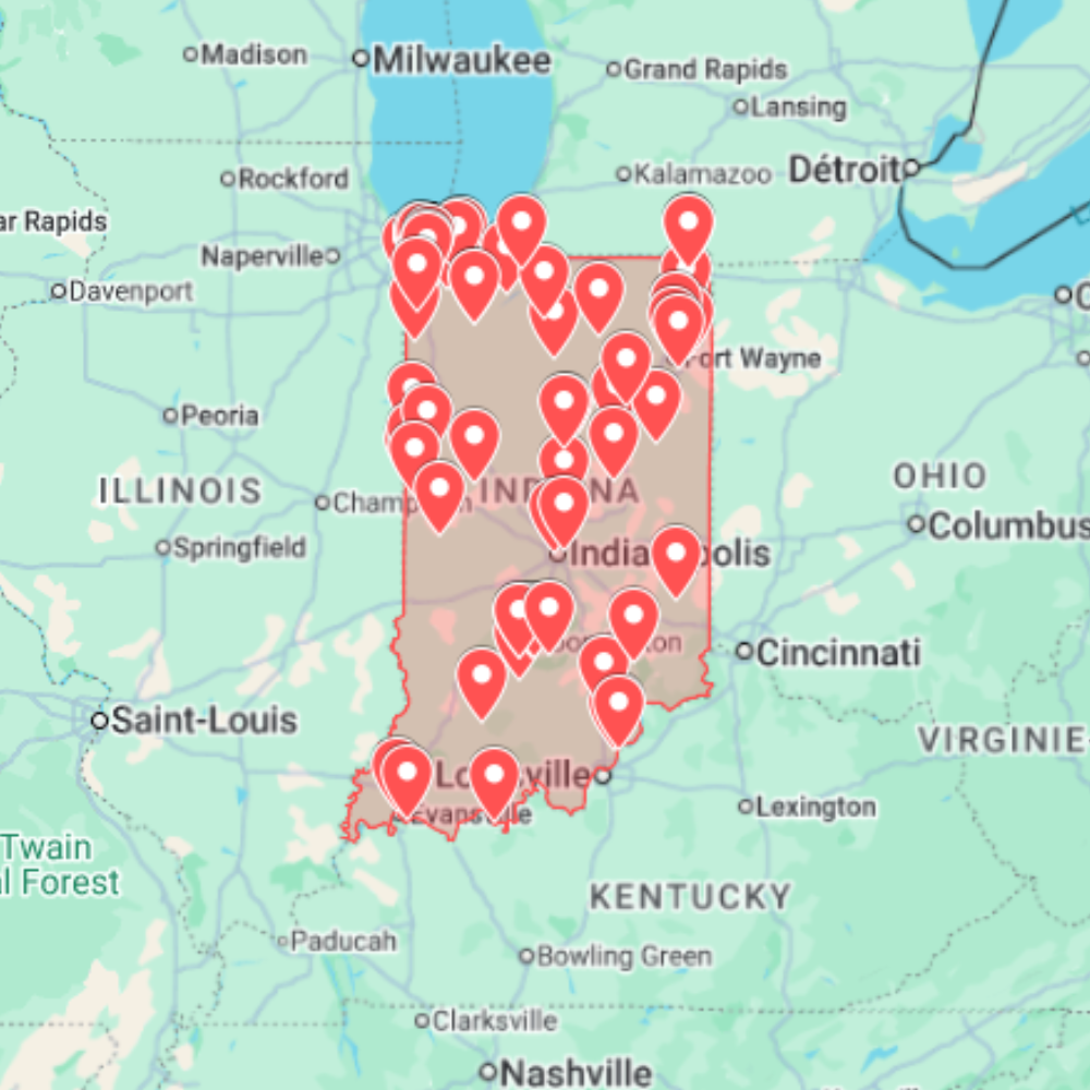
Searching for an abandoned places map USA can save hours of random scrolling, but it should never turn into a list of exposed private addresses. The useful approach is to build a route that combines public research, map layers, local context and a safety-first checklist before you ever leave home.
This guide explains how to plan urban exploration trips across the United States without sharing sensitive locations, encouraging trespass or relying on unreliable “secret spot” lists. If you want a faster starting point, you can also browse the USA urbex maps and compare other options from the country map hub.
What a good abandoned places map should include
A useful urbex map is not just a pin dump. For trip planning, the best map helps you decide which areas deserve research, which places are too risky or clearly off-limits, and how to group stops into a realistic day.
- Region or state coverage: so you can plan by distance instead of jumping between unrelated cities.
- Map compatibility: Google Maps, Google Earth, KML or GPX workflows make route planning easier.
- Basic context: type of place, visual clues, access sensitivity and whether extra verification is needed.
- No dangerous promises: avoid any source that guarantees legal access, “hidden entrances” or exact access instructions.
- Update discipline: abandoned sites change fast; demolition, security, redevelopment and weather can make old information useless.
Start with broad areas, not exact addresses
The safest way to use an abandoned places map in the USA is to start at the area level: state, metro area, industrial corridor, rural county or old transport route. This keeps research practical while reducing the risk of exposing fragile places online.
For example, instead of asking “what is the exact abandoned hospital address?”, use the map to identify a wider research zone, then verify legal status, visibility from public roads, current condition and whether the property is active, monitored or being reused.
A simple USA urbex route workflow
Route planning checklist
- Pick one state or metro area. Keep the first route compact; long drives create rushed decisions.
- Open your map layer. Use a curated urbex map, Google Earth/KML file or saved Google Maps list.
- Group possible stops. Cluster by drive time, daylight and backup options.
- Verify from public information. Look for redevelopment news, demolition permits, recent street imagery and obvious “no access” signals.
- Remove sensitive or unsafe spots. Active sites, sealed buildings, structurally dangerous places and private homes should be skipped.
- Prepare a backup plan. A good route still works if half the pins are no longer viable.
Google Maps, Google Earth and KML: which is better?
Google Maps is convenient for quick navigation and saved lists. Google Earth is better when you want to inspect terrain, industrial zones, rail corridors, roof condition, vegetation and historical imagery. KML files are useful because they can carry structured pins into Google Earth or compatible apps.
If you are working with KML, keep your files private, rename sensitive layers, and avoid publicly sharing coordinates. For a deeper workflow, read the guide on using Google Earth KML for urbex maps.
Safety and legality checks before visiting
Urban exploration involves real risks: unstable floors, exposed metal, asbestos, wildlife, security, local laws and changing property status. A map can support planning, but it cannot give permission to enter a site.
- Stay on public land or get permission where required.
- Do not force entry, damage property or remove objects.
- Never explore alone if the location is remote or structurally uncertain.
- Bring basic protective gear, charged phone, offline map and water.
- Leave immediately if a site appears active, monitored or unsafe.
- Avoid publishing exact coordinates for fragile or high-risk places.
How to compare abandoned places map sources
| Source type | Best use | Watch out for |
|---|---|---|
| Curated urbex map | Fast starting point for a state or country | Old pins, access changes, overexposed locations |
| Google Earth/KML | Layered route planning and visual checks | Files copied without updates or context |
| Forums and old blogs | Historical clues and place names | Dead links, outdated access, exact-address leaks |
| Local news and planning records | Current demolition/redevelopment status | Time-consuming research, mixed terminology |
| Social media | Recent visual confirmation | Misleading tags, recycled photos, location bait |
When a paid urbex map makes sense
A paid map is useful when you want to save research time, compare several areas quickly, or organize pins for a trip. It should be treated as a planning assistant, not a permission slip. Always verify current conditions and follow local rules before visiting any place.
You can start with the USA urbex map collection, browse maps by country, or go directly to the shop if you already know the region you want to explore.
FAQ: abandoned places maps in the USA
Is it legal to use an abandoned places map?
Using a map for research is legal in itself. Entering property without permission may not be. Always check local rules, signage, ownership and access conditions before visiting.
Can Google Maps show abandoned places near me?
Sometimes, but the results are inconsistent. Google Maps can help with navigation and saved lists, while Google Earth and KML layers are often better for scouting industrial areas, old infrastructure and route context.
Why not publish exact coordinates?
Exact coordinates can accelerate vandalism, theft, unsafe visits and unwanted attention. Responsible mapping focuses on planning value while protecting sensitive sites.
What should I bring on a first urbex route?
Bring offline maps, a charged phone, water, sturdy shoes, basic first aid, a flashlight, weather-appropriate clothing and a plan to leave if the location is unsafe or clearly restricted.