Explore Maryland’s Hidden Abandoned Locations
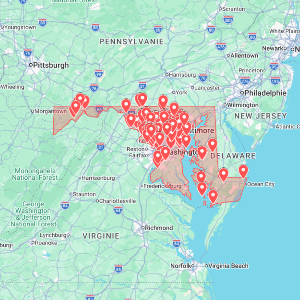
The Urbex Map Maryland is a comprehensive GPS database containing 223 abandoned places distributed throughout the state. Designed to simplify urban exploration, this digital resource allows explorers to access a curated collection of forgotten sites without relying on scattered online information or outdated coordinates.
Maryland offers an impressive diversity of exploration opportunities, from historic industrial facilities and military structures to abandoned hospitals, schools, and rural properties. This map brings these locations together into one organized format, making it easier to prepare road trips, photography sessions, or documentary projects.
Whether you’re exploring the urban surroundings of Baltimore or venturing into Maryland’s quieter countryside, this urban exploration map provides an efficient way to discover architectural landmarks and remnants of the state’s industrial and historical past.
Created for photographers, filmmakers, explorers, and architecture enthusiasts, this GPS map helps transform hours of online research into a well-organized exploration experience.
Cities & Regions Included
- Baltimore Metropolitan Area : Baltimore contains numerous abandoned factories, warehouses, commercial buildings, and former industrial complexes. The city’s manufacturing heritage creates a wide variety of urban exploration opportunities.
- Chesapeake Bay Region : Around the Chesapeake Bay, explorers may encounter abandoned maritime facilities, warehouses, docks, and former industrial infrastructure shaped by Maryland’s long relationship with shipping and commerce.
- Central Maryland : Central regions include abandoned schools, hospitals, office buildings, and forgotten institutional properties. These locations often showcase diverse architectural styles spanning several decades.
- Western & Rural Maryland : Western Maryland features isolated farmhouses, former railway infrastructure, abandoned churches, and small industrial sites surrounded by forests and rolling landscapes.
Types of Spots Included
This database includes a broad selection of abandoned locations such as hospitals, factories, warehouses, schools, hotels, office buildings, military installations, transportation infrastructure, industrial facilities, churches, residential properties, and historic public buildings. The variety of environments makes this map suitable for urban exploration, photography, documentary filmmaking, historical research, and location scouting.
Why Choose This Urbex Map?
✔️ 223 carefully organized abandoned locations
✔️ Structured GPS database for efficient planning
✔️ Instant digital download after purchase
✔️ Helps reduce research time dramatically
✔️ Compatible with Google Earth and Google My Maps
✔️ Designed for explorers, photographers, and content creators
Technical Specifications
- File Format: .KML / .KMZ
- Delivery: Instant Digital Download
- Compatible with: Google Earth
- Compatible with: Google My Maps
- Works on: Windows, Mac, Android & iOS
- Product Type: Digital Download Only
How to Install
- Download the map immediately after completing your purchase.
- Open Google Earth or Google My Maps.
- Import the provided .KML or .KMZ file.
- Browse the locations and start planning your next exploration.
The installation process takes only a few minutes on desktop or mobile devices.